Heavy rainfall, a tornado outbreak and unusually warm temperatures defined January’s bizarre weather.
Despite the recent run of warm, dry weather, January will go down as the 10th wettest on record.
4.39 inches of rainfall that fell at Dallas/Fort Worth Airport during January, making it the 10th wettest January on record
A total of 4.39 inches — including 3.16 inches on Jan. 15 — fell at Dallas/Fort Worth Airport, the official recording station. There was also a 10th of an inch of snow on Jan. 6.
All of that precipitation was well behind the all-time January record of 9.07 inches in 1932 and the second-place mark of 6.18 inches set in 2012.
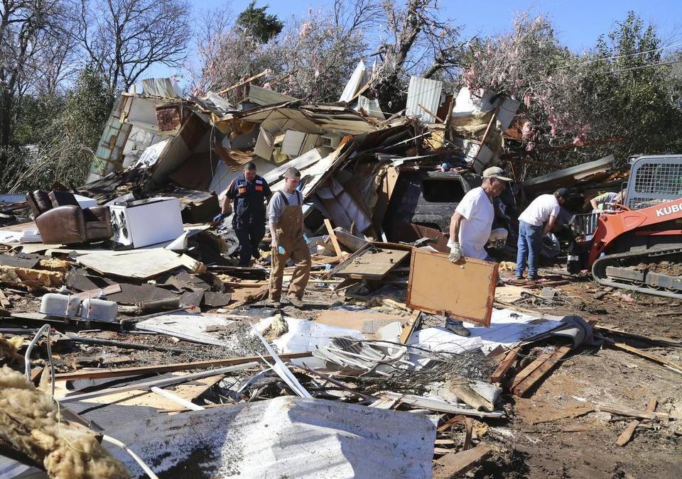
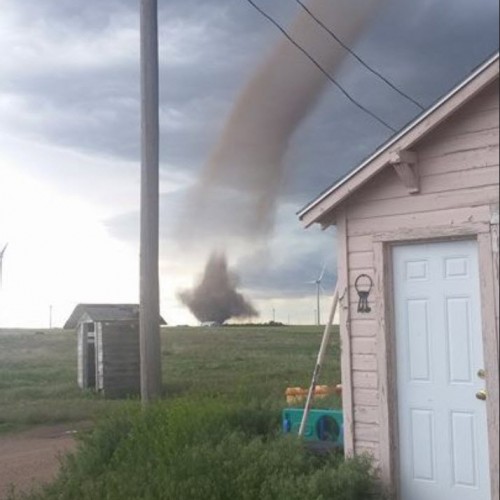
The month also saw an outbreak of tornadoes across North and Central Texas on Jan. 15-16 with six being confirmed, including one in Mansfield and one in Grand Prairie.
6 Number of tornadoes across North and Central Texas counties, which was the second-most ever during the month of January
That ties January 1998 as the second most tornadoes for North and Central Texas counties. The most January tornadoes occurred in 1996, when nine were confirmed.
A Texas A&M University researcher said January’s tornadoes could be a prelude to a wicked tornado season. Chris Nowotarski, assistant professor of atmospheric sciences at Texas A&M University, said the end of an El Niño pattern could lead to more twisters across Texas.
Last year, Texas had 90 tornadoes reported, which was significantly less than the 140 the state sees in a normal year.
“We’ve shifted to a weak La Niña this year, which suggests more typical numbers of tornadoes could occur this year,” Nowotarski said. “In fact, we’ve already had more than 90 tornadoes this year, which is well above the average number of 39 by this time, so indications are the tornado season is off to a strong start.”
For North Texas, it wasn’t just stormy, but warm, too.
This was the 13th warmest January on record with an average temperature of 50.6 degrees, which is above the normal average temperature of 45.9 degrees. The all-time January record of 55.5 degrees was set in 1923.
Tuesday continued to follow the trend with a high temperature of 80.
February will start off warm, but a cold front should drop temperatures Thursday and Friday into the 40s in the morning and 50s during the day.
Low humidity and strong winds were also bringing an elevated fire danger across the western half of North Texas on Tuesday.
Storms could return to North Texas this weekend with a chance of rain Friday night and Saturday.
“Right now, the chance of showers is isolated, but the models are still back and forth and not in agreement,” National Weather Service meteorologist Patricia Sanchez said.
by Bill Hanna
January 31, 2017 12:43 PM


