An outbreak of severe weather brought strong winds and large hail to much of Wyoming on Monday, even resulting in as many as 18 tornadoes across the state.
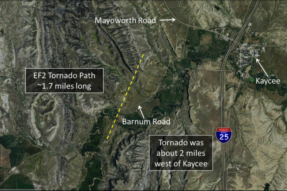
One of those tornadoes touched down two miles west of Kaycee in Johnson County. The National Weather Service has since rated that tornado an EF2 — the third category on a six-stage scale used to classify tornadoes based on the damage caused.
The Enhanced Fujita scale starts at EF0, for “weak” tornadoes with winds of 65-85 mph. The scale tops out at EF5, for “catastrophic” tornadoes with winds of at least 200 mph.
Monday’s tornado near Kaycee was ranked EF2 for “significant,” which includes tornadoes with winds of 111-135 mph. It touched down at roughly 5:30 p.m. and had estimated peak winds of 110-120 mph.
The tornado’s path was about 1.7 miles in length, crossing Barnum Road west of I-25 as it moved northeast toward Mayoworth Road, according to the National Weather Service in Riverton.
Storms first formed near Casper around 12:30 p.m. Monday, moving north-northwest into southern Johnson County and developing into supercells by 3-4 p.m.
The first tornadic storm developed around 5 p.m. over southwestern Johnson County near Barnum. Hail with a diameter of one to one-and-three-quarters inches was reported near Barnum by 5:15 p.m., increasing in size to two-and-a-half inches by 5:30 p.m. five miles southwest of Kaycee.
The National Weather Service says the storm produced “multiple vortices” as it approached Kaycee and Mayoworth. Tornadoes were reported between 5:35 p.m. and 5:50 p.m. as the storm slowly moved to the north-northeast.
A damage survey is still underway.
by Nick Learned
June 14, 2017


