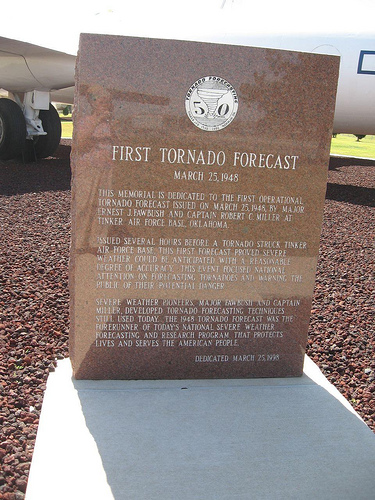
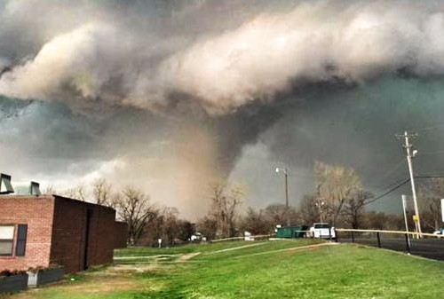
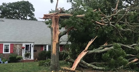
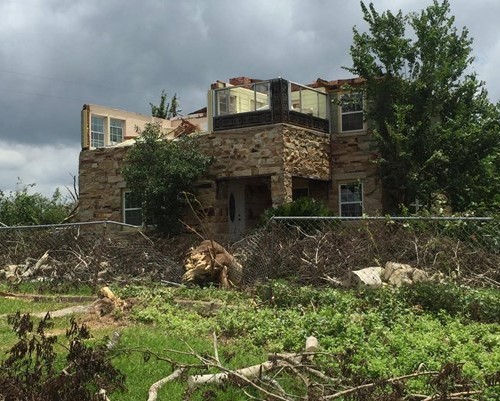
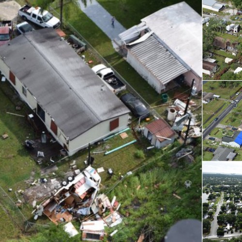
In the evening of March 25, 1948, a tornado roared through Tinker Air Force Base (AFB), Oklahoma, causing considerable damage, a few injuries, but no fatalities. However, the destruction could have been much worse. A few hours earlier, Air Force Captain Robert C. Miller and Major Ernest J. Fawbush correctly predicted that atmospheric conditions were ripe for tornadoes in the vicinity of Tinker AFB. The swirling funnel left $6 million dollars in damage, $4 million less than the first storm, which had occurred only five days earlier. The first tornado forecast was instrumental in advancing the nation’s commitment to protecting the American public and military resources from the dangers caused by natural hazards.
THE EVENTS LEADING UP TO THE FORECAST
Miller and Fawbush made this historic forecast with some reservation. Until March 25, 1948, tornadoes had not been forecast and many in the science community were uncertain that storms that developed so quickly and with such force could be forecast in advance.
A key factor in the command’s decision to issue the historic forecast on that day was a fierce tornado that swept through the same area only five days earlier, March 20, 1948. The storm left significant damage and some fatalities. Some wondered if that March 20, 1948, storm could have been forecast. A board that was convened to investigate decided that “due to the nature of the storm it was not forecastable given the present state of the art” and that “it was an act of God.” The board also recommended that the meteorological community consider efforts to determine a method of alerting the public to these storms and urged base commanders to develop safety precautions to minimize personnel and property losses in violent storms.
On March 21, 1948, the Commanding General of the Oklahoma City Air Material Area, Fred S. Borum, directed the Air Weather Service to have the Tinker Base Weather Station (under the command of Major Ernest J. Fawbush) investigate the feasibility of forecasting tornado-producing thunderstorms. For the next three days, Fawbush and Miller poured over surface and upper-air weather charts, and reviewed several other past tornadic outbreaks. They noticed certain similarities in the weather patterns preceding such storms. They also noted that others theories advanced by other researchers interested in the cause and behavior of tornadoes. “Using our findings and incorporating those of others … we listed several weather parameters considered sufficient to result in significant tornadic outbreaks when all were present in a geographical area at the same time,” said Miller.
The problem faced by the forecaster was to consider the current surface and upper air data, determine the existence of these parameters or the probability of their development, and then project the parameters in space and time in order to issue the “tornado threat area” with a reasonable degree of confidence and lead time. The size of the threat area would cover 20-30,000 square miles. Such a detailed forecast procedure was time and labor consuming and required intensive and specialized analysis.
On the morning weather charts of March 25, 1948, Miller and Fawbush noted a great similarity between the charts of March 20 and March 25, 1948. After analyzing the surface and upper-air data, a prognostic chart was prepared for 6 p.m. local time showing the expected position of the various critical parameters. This chart resulted in the somewhat unsettling conclusion that central Oklahoma would be in the primary tornado threat area by late afternoon and early evening. General Borum was notified and shortly thereafter arrived at the weather station.
After hearing these helpful observations, the General asked what time would be the most critical. “Between 5 and 6 p.m.,” said Miller and Fawbush. General Borum decided the forecasters should issue a forecast for heavy thunderstorms during that period. He patiently explained that such a move would serve to alert the base and put in motion a brand new, and detailed, base warning system into effect. The thunderstorm warning was issued.
As the day progressed, reports confirmed that the weather pattern was indeed strikingly similar to the weather patterns that produced the tornado on March 20. Events were moving more swiftly, however, and any organized severe weather activity would occur during the afternoon. Stations to the west and southwest began reporting building cumulus clouds shortly after noon. At 1:52 p.m. the first thunderstorm echoes appeared on the radar scope 60 miles to the northwest and extended 100 miles to the southwest. By 2 p.m. the thunderstorms were beginning to increase in number and size and organizing into a squall line. When notified of this development, General Borum headed for the weather station at once. The General spent 10 minutes scanning the radar scope and commented on the rapid development and increasing intensity of the squall line. By 2:30 p.m. Fawbush and Miller determined the line was moving toward Tinker at 27 mph, which would place it over the base near 6 p.m. General Borum stood up, looked at the forecasters and asked the unsettling question, “Are you going to issue a tornado forecast?”
Miller and Fawbush hesitated, pointing out the possibility of a second tornado striking the same area within 20 years or more, let alone in five days. “Besides,” Miller said, “no one has ever issued an operational tornado forecast.” “You are about to set a precedent,” said General Fred S. Borum.
Fawbush and Miller composed and typed up the forecast and passed it to Base Operations for dissemination at 2:50 p.m. As base personnel began carrying out the detailed Tornado Safety Plan, hangaring aircraft, removing loose objects, diverting incoming air traffic and moving base personnel, including the control tower personnel, to places of relative safety, Miller and Fawbush worried about a forecast “bust.” If the forecast was wrong, public confidence in weather forecasting would be set back years, not to mention their careers.
The squall line was fully developed by 3:30 p.m and continued to move steadily toward Oklahoma City. There had been no reports of tornadoes nor any reports of hail and high winds, as yet. Shortly after 5 p.m. the squall line passed through Will Rogers Municipal Airport, bringing a light thunderstorm, wind gusts to 26 mph and pea size hail. A little after 6 p.m. it began to thunder rather quietly and rain began. There was very little wind. Shortly thereafter, radio broadcasts were interrupted for an urgent news bulletin. A destructive tornado touched down at Tinker Field.
The base was in shambles. Poles and powerlines were down and debris was strewn everywhere. Emergency crews were busy trying to restore power, clear the streets and, in particular, to restore the main runway to operational status. General Borum’s Tornado Disaster Plan had been just as successful as the first operational tornado forecast. Miller and Fawbush became instant heroes.
70 YEARS LATER
The forecast issued by Fawbush and Miller on March 25, 1948, was the first step in establishing the organized warning and watch program that blankets and protects the nation today. As scientists learn more from tornado-intercept efforts and related research, the Department of Commerce’s National Oceanic and Atmospheric Administration (NOAA) continues to apply new technologies and better knowledge of how tornadoes form to improve the lead times for tornado warnings. Today, NOAA’s National Weather Service issues warnings and watches for the protection of life and property because two people had faith that scientists could predict tornadoes.
Edited for WeatherNation by Meteorologist Mace Michaels
March 26, 2018

