SULLIVAN, Wis (WMTV) – The National Weather Service (NWS) confirmed
the damage in Deerfield was caused by a tornado.
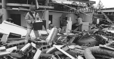
The EF-Zero tornado touched ground for four minutes and had winds topping 80 miles per hour, damaging the roof of a business and knocking over some trees. NBC15 reached out to the NWS in Sullivan to get more information about why storms like the one in Deerfield can come without warning.
There have been several pop-up tornadoes in Wisconsin this year that the NWS did not issue warnings for, including Deerfield.
Sean Miller, a meteorologist for the NWS in Sullivan, said they can’t always predict every storm.
“We have radar, and we look for a storm that may have some signs of producing severe weather. When we do see that we actually have something where we draw up a warning over a geographic area,” he said.
However, the fleeting storm in Deerfield did not prompt any warnings.
“Unfortunately with some of these smaller weaker ones, especially in the case of Deerfield one we saw the other day, those tend to not show up very well on radar and, unfortunately, don’t show up until they have touched the ground,” Miller said.
The way a tornado develops varies from storm to storm. Miller said it all has to do with where the tornado forms in the atmosphere, and sometimes the environment gives them enough clues to issue a warning ahead of time.
“It’s much easier to discern larger, stronger tornadoes, the kind that do widespread damage, and are the most impactful. Those are the kind of tornadoes you will see well in advance,” he said.
Miller said, when it comes to the smaller ones, often times the weather team will not detect it until it touches the ground.
There have been eight tornadoes in Wisconsin this year.
The NWS advises people to treat all storms as dangerous. Even though some can be weaker, they can still cause extensive damage.
by Caroline Peterson (2018, August 10) WMTV


