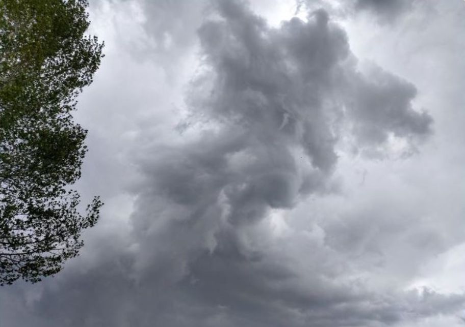
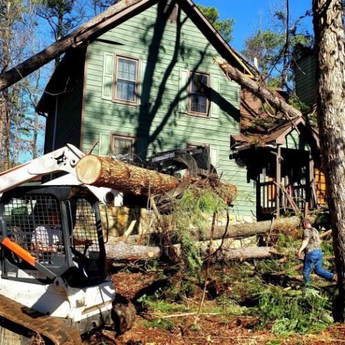
A tornado touched down in Southeast Idaho on Sunday afternoon and caused minor property damage.
Nationwide, recent storms have triggered a record number of twisters, causing extensive damage from Kansas to Pennsylvania.
Nicole Peterson, a meteorologist with the National Weather Service in Pocatello, said there were several funnel clouds reported on Sunday in Southeast Idaho, but only one touched the ground. That tornado touched down in the Riverside area near Blackfoot for 15 minutes and made a 1.8-mile path. There were no injuries.
Peterson said the tornado was weak and classified as a category zero on the Enhanced Fujita scale, meaning it brought wind speeds of 65 to 85 mph and was capable of causing light damage.
The funnel cloud was a type known as a “gustnado,” which is known to develop away from the main thunderstorm.
“Several cottonwood trees were snapped or uprooted along its path, with a resident reporting minor damage to a small greenhouse,” the National Weather Service wrote in a press release. “One eyewitness noted that as the gustnado crossed the Snake River, it briefly became a waterspout before continuing north of the Snake River.”
The tornado was reportedly strongest at 1:57 p.m., as it approached the river north of the intersection of West 300 South and Blackhawk Road.
Peterson said a tornado was also reported on Monday north of Mountain Home in southwest Idaho. That twister did not cause any injuries or significant property damage.
“We don’t get a lot of (tornadoes) here, but they’re not impossible or uncommon here,” Peterson said.
Peterson said the region is experiencing its severe thunderstorm season and it’s been wetter than normal. During the month of May, the Pocatello area had measurable precipitation from May 16 through May 27, she said. Peterson said the storm system is predicted to move on by mid next week.
Tornadoes are far more common, and typically more severe, in the Midwest, where cold air masses from Canada often collide with warm, moist systems from the Gulf of Mexico.
North Texas remained under a tornado watch until Wednesday evening, while the National Weather Service issued a flash-flood warning along the Oklahoma-Arkansas line as strong thunderstorms brought a new round of rain to eastern Oklahoma and western Arkansas, where the Arkansas River is expected to crest at historic levels.
In the east, multiple tornado warnings were issued for New Jersey and Pennsylvania. At least three tornadoes were confirmed in Pennsylvania on Tuesday.
In Kansas, the National Weather Service was still assessing the strength of a twister that injured at least 15 people Tuesday, three of them seriously, and damaged homes, trees and power lines in Douglas and Leavenworth counties in eastern Kansas.
“I’m just glad I found my two dogs alive,” said Mark Duffin, of Linwood, Kansas. “Wife’s alive, family’s alive, I’m alive. So, that’s it.”
Duffin, 48, learned from his wife and a television report that the large tornado was headed toward his home about 30 miles west of Kansas City.
The next thing he knew, the walls of his house were coming down, he told the Kansas City Star.
Tuesday marked the 12th straight day that at least eight tornadoes were reported to the National Weather Service. The previous record for consecutive days with that many tornadoes was an 11-day stretch in 1980. The weather service website showed at least 27 reports of tornadoes Tuesday, most in Kansas and Missouri but also in Pennsylvania and Illinois.
In Ohio, tens of thousands of Ohio residents were without power or water Wednesday in the aftermath of at least eight tornadoes that spun across the state Monday. One person was killed and more than 140 injured.
At least 60,000 people lacked water service in the Dayton area, where ice and water distribution centers were set up. A utility said power had been returned to some 35,000 customers Wednesday, but tens of thousands still were awaiting restoration.
Gov. Mike DeWine declared an emergency in three hard-hit counties, allowing the state to bypass purchasing requirements to speed up delivery of essentials like water and generators.
“We get our share,” DeWine told President Donald Trump on Tuesday, responding to the president’s remark in a personal call that he didn’t think of Ohio when he thought of tornadoes.
“Whatever we have to do, we’ll do,” Trump told the governor. “We’ll take good care of you.”
For Dayton resident Mike Harrington, Monday’s storms brought back memories of one of the state’s worst disasters. That happened on April 3, 1974, when one of the most violent tornadoes ever recorded struck Xenia, Ohio, 15 miles east of Dayton, killing 32 people and nearly wiping the city off the map.
Harrington, now 63, survived that 1974 storm, riding it out in a pitch black locker room at his high school where his track coach rushed athletes caught by the storm during practice.
On Monday, memories of that disaster came racing back as he stood outside his home near Dayton watching the lightning in the clouds and a cellphone alert told him to take cover immediately.
This time a twister roared through about 10 minutes from his house, one of at least three powerful storms that caused widespread damage in the Dayton area. At the church in Vandalia, where Harrington works as a multimedia specialist, the steeple was toppled and the building is so beat up that it may have to be torn down.
“It freaks me out to think I’m going to experience this again,” Harrington said Wednesday, standing outside New Life Worship Center. “I certainly don’t want to do that or have my wife go through that because it was something, it works on you emotionally.”
Winds from tornadoes weren’t the only problem across the Midwest and South. Several water rescues were reported in northern Missouri. Hannibal, Missouri, officials were just beginning to assess damage Wednesday, hours after torrential rain proved too much for the storm sewers, causing a break that resulted in water damage to buildings in the historic downtown area.
Outbreaks of 50 or more tornadoes are not uncommon, having happened 63 times in U.S. history, with three instances of more than 100 twisters, said Patrick Marsh, warning coordination meteorologist for the federal Storm Prediction Center. But Monday’s swarm was unusual because it happened over a particularly wide geographic area and came amid an especially active stretch, he said.
As for why it’s happening, Marsh said high pressure over the Southeast and an unusually cold trough over the Rockies are forcing warm, moist air into the central U.S., triggering repeated severe thunderstorms and tornadoes. And neither system is showing signs of moving, he said.
by Journal and wire reports (2019, May 31) Idaho State Journal


