Tornado watches were plastered across the eastern Carolinas on Thursday, with a spattering of tornado warnings popping up. It sounds like a typical outbreak of summertime severe weather, but the weather forecast for the coastal Carolinas is far from ordinary: There’s a Category 3 hurricane bearing down on them.
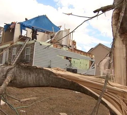
Twisters began spinning up in Dorian’s outer rain bands Thursday morning, causing damage in Brunswick County, N.C. Another tornado passed near Myrtle Beach, S.C., shortly before sunrise. The National Weather Service has logged more than five reports of tornadoes or waterspouts (which are tornadoes over water).
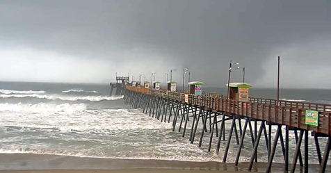
At 9 a.m., a large waterspout appeared just off Emerald Isle. It is unclear whether it made landfall as a tornado. The circulation strengthened about five miles inland northwest into Onslow County, N.C., producing a tornado that tossed debris more than a mile high. Radar indications suggest it was uncharacteristically strong for a tornado spawned by a tropical cyclone.
More tornadoes can be expected throughout the day Thursday. A tornado watch remains in effect until 7 p.m., with the Storm Prediction Center citing a “high” likelihood of “several tornadoes.” The center also issued an “enhanced risk” warning for severe weather, producing an unusually bullish tornado forecast. The atmosphere seems to support such predictions.
The most likely locations for tornadoes will be within a county or two of the coast from near Charleston, S.C., to the North Carolina/Virginia border. Anyone north of Dorian’s eye should be prepared to seek shelter quickly if a tornado warning is issued. Tornadoes spawned by tropical cyclones are known to develop very suddenly and be very transient in nature. They’re also usually tough to see because of low cloud bases in hurricanes. The local National Weather Service offices have proved adept early Thursday in detecting the circulations, which ordinarily appear more subtly on radar, compared with traditional tornadoes.
Hurricane-spawned tornadoes are the worst of both worlds, but, unfortunately, the two go hand in hand. “Spin begets spin,” said Capital Weather Gang’s Andrew Freedman. Rotating systems tend to have smaller vortices embedded within them. In the case of hurricanes, that means it’s easy for smaller whirls — tornadoes and waterspouts — to spin up in the highly sheared outer rain bands.
When a hurricane’s squalls move ashore, the winds in the lowest levels of the atmosphere slow down while air just above the ground rushes on unimpeded. That change of wind speed/direction with height represents shear. That effect is compounded by outflow winds exiting Dorian’s eye at the upper levels and expanding clockwise, counter to the surface-based inflow. The result? Thunderstorm cells that extend through deep layers of the atmosphere will feel a twisting force. It’s easy for tornadoes to develop by the dozen, particularly in the “front right quadrant” relative to the storm’s center. The vast majority of all tropical cyclone-related tornadoes form 150 miles or more away from the storm’s center.
Closer to the center of a hurricane, tornado-like “miniswirls” can occur, as well, although their formative processes are quite different. These tend to be smaller and weaker but can cause extreme damage when embedded in already-screaming eyewall background flow. Additional whirlwinds called “tornado-like vortices” and “roll vortices” can compound the extreme damage in the eyewall.
Tornadoes are oftentimes an underrated hazard in tropical cyclones, overlooked because they frequently develop ahead of the hurricane’s more noteworthy eyewall. But the winds inside any tornado can be just as strong.
Some years, the United States sees 10 percent or more of its annual tornado count stem from a single overachieving tropical storm or hurricane. Ivan in 2004 dropped at least 117 tornadoes from Florida to Maryland. Frances, a week and a half earlier, spun up 103. And in 1967, Hurricane Beulah produced an impressive 115 twisters.
by Matthew Cappucci (2019, Sept 5) The Washington Post


