At 12:41 a.m. on March 3, a 911 operator answered the call of a panicked man under the Jefferson Street Bridge in Nashville.
“Are there current tornadoes on the ground?” he asked.
The operator barely had a chance to respond.
In the next instant, a forceful wind roared across the phone line.
For 33 seconds, there was nothing but the impossibly loud sound of a violent tornado.
When it passed, the man on the other end still gripped his phone, but there was silence.
“Hello?” the operator asked. Seven seconds passed. “Hello?” the operator said again.
Twenty more seconds went by without a word. Then came a meek cry.
“Help,” the man said.
“Hello, sir, are you OK?”
“Help,” the man said again, his voice rising as he assessed his surroundings. “I’m at the Jefferson Street Bridge. I’m trapped.”
As shock turned to panic, he screamed. In the background, others echoed his cries.
“There’s a bunch of people in here,” he said. “I know a lot of people need help.”
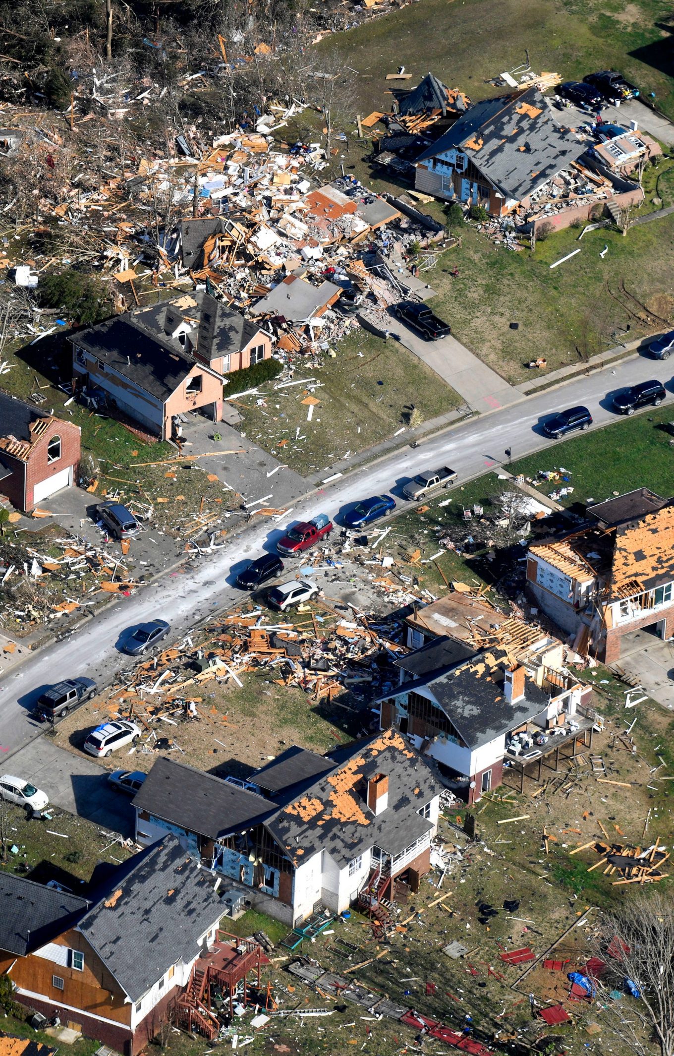
Similar scenes of terror and uncertainty unfolded across Middle Tennessee in the early hours of March 3 as brutal storms besieged the region, cutting a broad swath of destruction and taking the lives of those who were dearly loved.
Twenty-five people died; 310 were injured. Thousands of buildings were destroyed.
To many, it felt like Tennessee’s tornadoes came without notice.
A tricky forecast, which climaxed in a worst-case scenario, caught everyone off guard. And when the mounting concern by storm-monitoring meteorologists peaked, many residents were already asleep in their beds, unaware of the new watches and warnings being issued across the state.
Even with the pending storm’s slight tornado risk noted throughout the day, the reality of the quickly changing environment left mere minutes for people to find shelter.
‘It looked like it would be one of those near-miss days’
On Monday morning, the National Weather Service’s Storm Prediction Center in Oklahoma gave Nashville a 2% risk of tornado — the smallest number it will assign.
Still, for this time of year, it was noteworthy.
Tennessee’s tornado season peaks in February, March and April, and in the fall around November.
Since 1995, Tennessee has averaged 30 tornadoes a year.
“This time of year, we know it doesn’t take a lot to produce tornadic storms,” said Grady Dixon, a dean of the College of Science, Technology and Math at Fort Hays State University and a meteorologist who studies tornado climatology.
And that Monday, a cold front was moving toward Tennessee, one with a low pressure system primed to create a supercell — a dangerous, rotating type of thunderstorm.
At 5:50 a.m., the National Weather Service in Nashville noted the growing “strong to severe threat.” But, it tweeted, on a scale of 0 to 5 the risk associated with possible tornadoes in Middle Tennessee that night was a 1.
By lunchtime, that risk had increased slightly to 5%.
But the main threat remained large hail and locally damaging winds, with most of the instability concentrated outside the state, around the boot heel of Missouri, Dixon said.
Nashville appeared to be missing some key ingredients for a more significant threat.
Tornadoes begin to form when warm, muggy air at the surface rises and meets colder air above, creating thunderstorms. By itself, that is not enough. There also needs to be rotation. That is caused when winds in the upper atmosphere blow in a different direction than the winds closer to the ground, creating what are called wind shears.
In Middle Tennessee that night, the winds about a mile above the earth’s surface — the ones responsible for the wind shears that initiate a rotation — were relatively weak.
And, because it had been overcast in the area during the day, there was not a lot of warm air to rise.
“It looked,” Dixon said, “like it would be one of those near-miss days.”
‘A tiny change in wind’
While most thunderstorms form in a line and feature multiple updrafts — or pockets of rising air — supercells are different. They have only one extremely powerful updraft. As they move, they gobble up the surrounding air, using it as fuel.
The day had been cautioned with only slight concern. But, as night deepened, the winds higher in the atmosphere got unpredictably stronger and the supercell took advantage.
“A tiny change in wind, in this case, made a huge change in outcome,” Dixon said.
Tornadoes are ranked on a scale of 0-5 called the Enhanced Fujita scale:
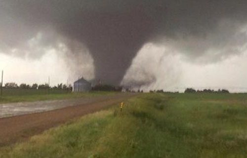
At 10:15 p.m., a storm chaser captured a photo of a tornado 4 miles east-northeast of Malden, Missouri, about 80 miles west of the Mississippi River.
The first Middle Tennessee tornado — 11:05 p.m. March 2
Location: Benton and Humphreys counties
Rating: EF2
Peak wind: 125 mph
Length: 18.95 miles
Width: 250 yards
Time on the ground: 26 minutes
People killed: 1, with 2 injured
It began in Benton County, touching down at 11:05 p.m. and roaring toward the Tennessee River.
It toppled trees as it spun toward Carl Frazee’s mobile home on Bethel Church Road.
When he heard the storm, he ran into the room where his longtime girlfriend, Patricia Kendall, slept on the couch. He threw his body on top of hers.
In a flash, the storm picked them up and tossed them across the road — about 150 yards away from where their trailer sat.
Frazee was dead. Kendall went to the hospital, gashes on her head.
The tornado continued across the Tennessee River into Humphreys County and damaged hundreds of trees along the river on Crystal Springs Road.
It dissipated around Highway 13. But there was much more to come.
‘That’s a lot harder to predict’
In Tennessee, as seasons change from winter to spring, warm, humid air from the Gulf of Mexico begins to edge toward the state, creating a seesaw of moist and dry days.
At the same time, temperatures fluctuate more. Air near the earth’s surface may start to warm, while several thousand feet up it remains cool. These disparities of temperature are often the necessary ingredients to create a tornado.
But this storm was a little bit different.
“It was driven almost entirely by a low pressure center getting stronger in response to a cluster of thunderstorms,” Dixon said.
A low pressure area usually begins to form as air from two different regions collides and is forced upward, cooling as it rises. The rising air creates a giant vacuum effect, and moisture within the air condenses to form clouds and rain.
As the air rises, other air must rush in from the sides to replace it. The faster it goes, the more intense the exchange becomes. This sometimes creates strong winds, but not always.
“Trying to monitor winds flowing into a low pressure area — and whether they are going to get stronger or weaker — that’s a lot harder to predict,” Dixon said.
Still, meteorologists tried. At 11:20 p.m. on Monday night, the Storm Prediction Center issued a very small tornado watch for portions of western and central Tennessee. It included 13 counties, including Nashville’s Davidson County.
But first would come a stop in Humphreys County.
The second tornado — 11:42 p.m. March 2
Location: Eastern Humphreys County
Rating: EF0
Peak wind: 80 mph
Path length: 4.8 miles
Width: 50 yards
Time on the ground: 6 minutes
People killed: None
It touched down along Curtis Chapel Road, damaged a small barn, uprooted a few trees and then disappeared.
According to the National Centers for Environmental Information, approximately 77% of tornadoes in the United States are considered weak (EF0 or EF1) and about 95% of all tornadoes nationwide are EF2 intensity or below.
Perhaps that is why no one panicked as the supercell continued eastward across the state, with intermittent tornado warnings accompanying the storm.
That’s not to say that no one was watching.
At 12:11 a.m., a severe thunderstorm warning was issued for areas including Nashville and Hendersonville, warning of possible 60 mph wind gusts.
At 12:31 a.m., the National Weather Service in Nashville tweeted a “heads up” to Metro Nashville that the storm was moving into northern Davidson County.
“The storm is not as strong currently, but is still capable of producing hail to the size of golf balls,” it said.
Four minutes later, the National Weather Service issued a tornado warning for Davidson, Sumner and Wilson counties, and a twister touched down directly over the John C. Tune Airport, tossing airplanes around like toys.
The terminal and 17 airplane hangars were destroyed. The airport was hit without a warning.
‘A hot spot for nighttime tornadoes’
In tricky forecast environments, meteorologists rely on multiple tools.
Doppler radar has made it possible to detect a tornado’s winds. But not all tornadoes occur in situations where the radar can “see” them.
So, meteorologists also use something called ground truth, which combines computer-generated weather models with observational data from people on the ground where the weather is actually happening.
Often forecasts can be improved during the day by monitoring information from storm spotters, said Kelsey Ellis, a hazard climatologist and associate professor of geography at the University of Tennessee.
“At night,” she said, when it gets dark and it’s harder to see, “that comes to a halt.”
For Tennessee residents, overnight tornadoes are a regular and terrifying reality. In fact, according to Ellis’ research, nearly half of tornadoes that occur in Tennessee strike when the sun is down and people are unaware.
Nighttime tornadoes, Ellis said, are more than twice as likely to be fatal.
The third and longest tornado — 12:32 a.m. March 3
Location: Davidson, Wilson and Smith counties
Rating: EF3
Peak wind: 165 mph
Path length: 60.13 miles
Width: 800 yards
Time on the ground: 1 hour, 3 minutes
People killed: 5, with 200 injured
At 12:39 a.m., the National Weather Service tweeted: “TAKE COVER NOW IF YOU ARE IN DAVIDSON, WILSON, OR SUMNER COUNTIES!”
One minute later, a man named Patrick called 911 as he searched for his co-workers among the rubble at Best Brand Liquor Distributors on Cockrill Bend Boulevard in North Nashville.
“We just got hit by a tornado,” he said to the operator as he processed the scene around him.
“You all right, Joe?” he shouted to a man nearby. “Where everybody else at? You find anybody else?”
It’s rare that dense urban areas are destroyed by tornadoes — typically because tornadoes aren’t on the ground long enough to track through big cities.
“The odds of a tornado dropping right on a city are astronomically low,” Dixon said.
But Nashville had been a target before. In 1933, an F3 tornado brought on by a fast-moving cold front on a mild winter day crossed the Cumberland River and traveled east, claiming 1,400 homes and killing 15 people.
It happened again in 1998, when a twister roared down Broadway, blowing out skyscraper windows and devastating churches and homes in East Nashville. One person died from the F3 tornado, and the storm left more than $100 million in damage.
March 3, 2020, marked the third hit to the city. All three tornadoes struck the Five Points area in East Nashville.
This time, the tornado covered more than 60 miles, stretching 800 yards wide. Five people were killed, including a couple married 58 years, who died side by side on a mattress thrown from their bed.
Tornado 4 — 1:37 a.m.
Location: Smith and Putnam counties
Rating: EF0
Peak wind: 75 mph
Path length: 5.99 miles
Width: 50 yards
Time on the ground: 5 minutes
People killed: 0
An EF0 tornado touched down near Club Springs Road just north of the Caney Fork River, and then moved northeast across the hilly terrain, taking down several trees in the process, before lifting away.
Minutes later, the rotation in the thunderstorm strengthened again.
At 1:48 a.m., the National Weather Service issued a tornado warning for Cookeville, identifying “a severe thunderstorm capable of producing a tornado.”
A typical tornado travels at around 10 to 20 mph, according to the National Severe Storms Laboratory. The tornado about to cut through Putnam County flew forward at upwards of 60 mph.
“That is unbelievably fast,” Dixon said. “That is so fast you can’t get away from that even driving on a road that is perfectly straight.”
The fifth tornado, the strongest and deadliest in years — 1:49 a.m.
Location: Smith and Putnam counties
Rating: EF4
Peak wind: 175 mph
Path length: 8.23 miles
Width: 500 yards
Time on the ground: 7 minutes
People killed: 19, with 88 injured
When the tornado touched down west of Cookeville, the first people hit had only 60 seconds of warning.
The tornado cut a scar 8 miles long and was on the ground seven minutes. Nothing in its path stood a chance.
When 15-year-old Zachary Hutchinson went to bed Monday night, he was looking forward to a day off. Putnam County public schools were closed for Super Tuesday elections.
He was instead jolted from sleep as the tornado’s strength mounted to EF3, ripping the roof off his family’s home in Charlton Square and pinning his 26-year-old sister underneath an overturned dresser and chimney bricks.
Then the storm became even more violent, raging to 175 mph winds and EF4 intensity.
A neighborhood of newly built homes off N. McBroom Chapel Road was hardest hit. Four children and seven adults were killed there. Dennis Padiernos and his wife lived near the area off Hensley Drive, which ends in a cul-de-sac and lost nearly every home.
“We are not moving back,” he said with tears in his eyes. “Too many people have died.”
The sixth tornado — 2:05 a.m.
Location: South Putnam County
Rating: EF0
Peak wind: 75 mph
Path length: 0.23 miles
Width: 25 yards
Time on the ground: 1 minute
People killed: 0
The sixth tornado lasted barely a minute, breaking off a few tree branches and damaging a metal garage, but the toll had been taken.
The tornado in Putnam County was the deadliest in Middle Tennessee since 1933.
For Ellis, it serves as a reminder: One warning system isn’t enough.
The National Weather Service issued alerts.
The @NashSevereWx Twitter account, which works closely with the National Weather Service to disseminate emergency information, pushed out tweets throughout the night, even switching to a live broadcast on Periscope.
Local broadcast meteorologists were on air from the time initial warnings were issued around midnight until the threat was over hours later.
Still, so many were caught unaware, undisturbed by the storm outside, unshaken by sirens and alarms. For some, until it was too late.
The seventh, and final, tornado — 2:25 a.m.
Location: South Putnam County
Rating: EF0
Peak wind: 85 mph
Path length: Still being determined, at least 2.24 miles
Width: 150 yards
Time on the ground: Still being determined
People killed: 0
Since 1995, Middle Tennessee has averaged 17 tornadoes a year.
Ten tornadoes touched down across the state late on March 2 and into the early morning hours of March 3.
Seven of the tornadoes affected Middle Tennessee.
The final storm in the string of deadly twisters touched down near the intersection of Highway 127 and Atkins Road.
One single-wide mobile home sustained roof damage, two houses had shingle damage, one power pole was pushed over, and about 20 trees were uprooted.
And there the vicious storms made their final mark. They swept away homes and took away lives. They left a 100-mile scar from west to east.
A system that made weather forecasters wary, but one that no one anticipated would turn so violent.
by Jessica Bliss (2020, Apr 2 | Updated 2020, Apr 3) Nashville Tennessean


